The Chinese Academy of Forestry (CAF) has been actively engaged in desertification cambating and control research since the early 1950s. Over the past fifty years, continuous efforts across several generations have led to pioneering breakthroughs in the basics and technologies of desertification combating. These achievements have been widely applied in practice, resulting in substantial ecological, social, and economic benefits and integrated into national-level strategic studies and extensively utilized in major ecological projects, providing crucial technological support for desertification control and ecological construction in sandy areas in China, and offering technical support for the Chinese government to fulfill the United Nations Convention to Combat Desertification.
In the early stages of the preparatory work for the Dengkou Experimental Base, sand-fixing plantations have been experimented in Yulin since 1950s’ and seven site-appropriate bush species were selected. The study of site classification of Mu Us Sandy Land was started in 1980s’ and research results included a formulated quantitative table of its site quality and an approach combining grassland, forestry and agriculture ecosystems with emphasis on bushes, which was applied extensively in Mu Us Sandy Land and helped increase plant survival rate by 15%.
A shelterbelt network has been built in Ulan Buh Desert, establishing a man-made oasis of 1,486 ha. Quantitative indicators were developed comprehensively and systematically against the environmental quality improved by large-scale greening programs for the first time, which proved that shelterbelts could effectively mitigate the atmospheric evaporation by 30-40%, alter the wind-drift sand flow, and thus reduce the hazards brought by sand storms. This played a crucial supporting role in the transformation of desert areas in the northwest of China and the construction of the Great Green Wall of China.
The decade-long study revealed the rule of desertification occurrence for the first time. A theoretical framework for the occurrence, development, monitoring, and evaluation of desertification was established. To meet the significant ecological construction needs, 11 plant species for desertification control under extreme environmental conditions were selected and the control approaches for four typical categories of desertification were established, which were demonstrated in a total area of over 6,700 ha. This provided technical foundation and demonstration models for improving the effectiveness of desertification control.
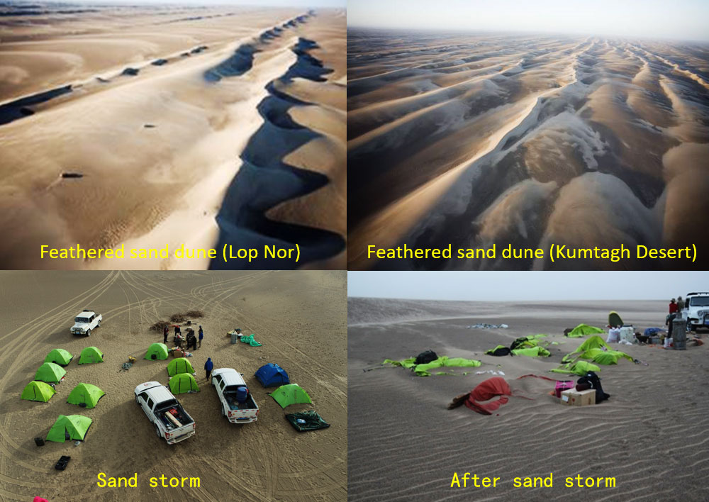
Since 2007, with the support of the National Special Program of Basic Research Work of Science and Technology, the Chinese Academy of Forestry has organized 18 industry-university-research institutes to collaboratively conduct surveys of basic data in the Kumtagh Desert, which cover various aspects including geology, landforms, climate, hydrology, soil, vegetation, fauna, microorganisms, and more. The surveys revealed the formation, evolution, and distribution patterns of the desert. The team completed a series of natural geography maps for the Kumtagh Desert, including geological maps, landform maps, water system maps, vegetation maps, and soil maps, etc. Eight monographs were published, such as Geomorphological Map of the Kumtagh Desert, Research on the Kumtagh Desert, and Atlas of the Natural Geography of the Kumtagh Desert, which filled the gaps in scientific explorations of deserts, Gobi, and sandy areas in China. Additionally, the investigation and compilation of China’s desert plant resources were carried out, covering plant germplasm resources in major deserts and surrounding areas. The team published the Atlas of China Desert Plants and established a platform for the investigation, monitoring, and resource information sharing of China’s desert plants. The research focused on the principles and models of low-coverage windbreak and sand control. For the first time, it was discovered that the sand flow can be effectively fixed if the vegetation coverage reaches between 15%-25%, The team summarized the principles of sand control with low vegetation coverage and developed a series of new technologies and models for sand control. Furthermore, the research delved into the hydrological impact of forest vegetation and coordinated management techniques in arid and water-deficient areas of Northwest China, replaced the measurement of "annual precipitation limitations" with "water resource limitations" in forestry construction, and quantitatively revealed the hydrological impact of the systematic structure and spatial pattern of forest vegetation.
The study proposed an indicator system for vegetation carrying capacity which takes water resources into consideration, as well as a decision support system and key controlling technologies. These research outcomes provided important technological support for projects such as the Great Green Wall of China, the control over the sources of sandstorms affecting Beijing and Tianjin, and international cooperation in desertification control with Mongolia and Arab countries, as well as China’s fulfillment of the United Nations Convention to Combat Desertification.
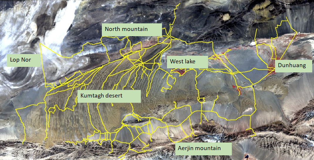
Integrated Scientific Survey on Kumtagh Desert